Wednesday, November 11, 2009

Gone Caving!


Not many people know that your activities in the Canadian Rockies don't all have to be out in the open. Canmore is home to the Rat's Nest Cave and Canmore Cavern's runs tours into this amazing cave system.

No experience is necessary and they kit you out with coveralls, helmet and headlamp and a certified guide to make sure that you have a safe and fun experience.

There are two options; the Adventure Tour involves a 60 foot rappel along with the climbing, crawling, squeezing, grunting, and groaning that goes along with the Explorer Tour.

I did the Explorer Tour - mostly because it was less $$ than the Adventure Tour - and loved every second of it.

We met our guide and followed her to the cave entrance where we put on our kneepads, coveralls, helmets and headlamps and strapped on our safety harnesses. The adventure started off with a slide down the smoothest rock surface I've ever encountered. Think the slide at your local playground, that's how smooth it was.

Within seconds it became apparent how important it was to have a guide with you. She lead us away from the 60 foot drop and towards what looked to me to be a solid wall of rock. That is until the guide hunkered down on her hands and knees and disappeared under an outcrop.

Being in a cave is amazing. My sense of equilibrium was way off as my peripheral vision ended where my headlamp light stopped. You have no horizon to orient yourself with and the floor of the cave is pitched in every which way but level. The crab walk was the preferred method of motion for my friends and I.

Through tunnels and down slopes we scrambled and crawled until we were 55 meters below the trail that we hiked up to the cave entrance on. The cave is always at 5 C and there is only a small amount of humidity. Just enough to dampen the knees and bum of your coveralls. After we tried out our spelunking skills with a few tight spots (arms up or down - not under because now you're wedged!) we started back towards the entrance.

I have a really good sense of direction, but in that cave I was totally lost. We got to a spot called the 5 way cavern and I had no idea which way to go, never mind which way I had just come from. Guide to the rescue once more! The exit is right where your knee is!

The most challenging part of our caving adventure was the same smooth as glass piece of rock that we had slid down to get into the cave. What goes up, must come down - or rather, what goes down, must come up! I'm not very flexible at the best of times so I cannot explain how in the world I managed to get my knee into a gripping point that was up by my shoulder. The day after I sure felt it though!

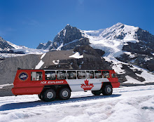
Canmore is an hour’s drive from Lake Louise and if you’re not into driving that far for a day trip, you can choose to stay at the ACC Clubhouse (an HI affiliate hostel) in Canmore, or at the HI-Banff Alpine Centre.

Rates for Canmore Caverns’ excisions start at $99/person and they offer a range of different spelunking activities.

Wednesday, October 14, 2009

Horseback ride up to the Plain of six glaciers

On a warm summer day it was time for the 4 hours horseback ride up to the
`Plain of six Glaciers`.
I decided to go with Timberline Tours.
Our lovely guide with my horse for the day named Snowball.
Mt Victoria with the Victoria glacier.

Lake Louise on our way back down.
Some plant I unfortunately do not know the name of
which looks very interesting never the less.
To sum it up:
It was a great experience
but I would recommend to take a shorter ride
if one has not been on a horse before...

Mount Fairview

Mount Fairview in Banff National Park was named in 1894
by Walter Wilcox.
Mt Temple.

You can see the Lake Louise Ski Hill in the distance.


Close up.

A hoary Marmot sunbathing.


A great view while descending.

Random shot's around Lake Louise

Julia is a Front Desk Agent and in Lake Louise since April
Here some random shots I took around Lake Louise falling in love with the place.
Hector Lake is a small glacial lake and has a total area of 5.23 km2 (2.0 sq mi). It is named after James Hector, a geologist and naturalist with the Palliser Expedition.
A puddle in our parking lot mirroring the trees around the hostel.
On of the few sunsets I was fortunate to witness since I love working pm and so miss lots.


Sunrise close to Takakkaw Falls in Yoho National Park.


Clouds in the beautiful Alberta sky.

Monday, October 12, 2009

Burgess Shale - Walcott Quary Hike

Chelsea Turnbull is the interim General Manager of the HI-Lake Louise Alpine Centre. A long term resident of Lake Louise, she tries to squeeze in as much hiking as she can in between answering e-mails and ordering toilet paper.

Walcott Quarry
Wednesday, September 9th, 2009


With summer quickly coming to a close I realized that time was running out for me to take advantage of our partnership with Parks Canada for the Burgess Shale hikes. A quick e-mail was sent, "Hey, any chance I could get on Wednesday's hike?" without actually looking at the details of the hikes.

I get an e-mail back a few hours later, "Sure thing! We've signed you up for Walcott, see you at Takakkaw Falls parking lot at 7:15am!"

Great! I marked the date, location and time down. Later on I took a look at the guest information sheet that was put together earlier in the year with driving times and directions. And that’s when I make a shocking discovery. I'm not signed up for the short 7km Mount Stephen hike. No…I'm on the long, 22km long, Walcott Quarry Hike! Not exactly what I thought I was signing up for, but I did Paradise Valley a few weeks ago so I’m not totally overwhelmed by the distance.

Wednesday rolls around and my alarm goes off at 5:30am. I haven’t used my alarm clock in at lest 3 months and I’m pretty sure that this is the earliest I’ve been awake in at least 2 years! I crawled out of bed, tossed my lunch together, filled up my water, located my toque and gloves after a few minutes of frantic digging, stuff everything into my pack and at 6:30am sharp, head out the door...leaving my freshly brewed coffee sitting on the kitchen counter.

I arrive a few minutes after 7am at the Takakkaw Falls Parking lot. Its a bit eerie since there is one other car and that’s it. Normally the parking lot is absolutely packed full of people who make the short stroll to see Takakkaw Falls and have no idea how much their missing by not exploring a bit further afield. (Twin Falls is one of my most favourite hikes in Yoho.)

Cursing myself for forgetting my coffee (going to have caffeine withdrawal by 10am!) I jump out of my truck into the frosty morning air. It’s COLD at 7am in September! My pack is almost empty since I now have on my toque, gloves, extra sweater, and my rain jacket. Did I mention that I’m also wearing long underwear?

Our group gathers together. On today’s trip we have a couple of geologists from the Czech Republic (They were camping at Takakkaw Falls! Did I mention how cold it was that morning?), avid hikers from Kamloops, an amateur palaeontologist from Edmonton and a couple from Canmore who are ‘finally getting around to this hike.’

A short note on Guided Hike Etiquette. ARRIVE ON TIME! We were due to depart the parking lot at 7:30, but thanks to people showing up 20 or 30 minutes late, we didn’t leave until after 8am. That’s a lot of time to stand around in the cold for!

A short stroll past the falls and the HI-Whiskey Jack Wilderness Hostel (a great alternative if you don’t feel like getting up in the wee small hours and camping isn’t your style) and we’re on our way to Yoho Lake, striping off extra layers as we head up the 290m elevation gain. The sky is overcast and we’re hiking through the trees for the greater part which lends a nice ambiance to the morning.

After a short break at Yoho Lake next to a monument showing that this is where the Alpine Club of Canada set up its first annual camp in 1906, we head out on the Burgess Pass trail.

This was when things got really spectacular. While the Yoho Lake trail is nice and peaceful and fully embraces the wooded walk ideal, the Burgess Pass is the ultimate alpine hike! The trail skirts along the slopes of Wapta Mountain with towering (and fragile looking!) cliffs of schist, zebra rock, and all sorts of wildflowers and mushrooms consistently distracting us from the stunning views of the valley below. You don’t know where to look first and there is so much to see its hard to take a picture.


After a quick lunch, the final push to the Walcott Quarry section of the Burgess Shale was next on the agenda. Unfortunately by the time we got to the final push up the hill to the Quarry (lots of signs telling you that you’re in a restricted area and on camera!) , the weather had started to deteriorate. Nothing like hiking in snow! Poor weather, plus the fact that we had been late to start and had some very slow hikers in our party, meant that we didn’t have much time at the Quarry itself.

The guides who lead you into this area are well prepared. At the Quarry, there is a locker with excellent fossil examples and more detailed information up there as well as little magnifying glasses for you to get right up close and personal with the fossils. We were able to spend 30 minutes exploring the Quarry and its treasures and while you cannot take any souvenirs with you, the guides have tracing paper and pencils for you to take an impression of your favourite trilobite.

I am NOT into fossils. I was more interested in taking pictures of mushrooms and the views than I was of the fossils, however even a non-paleo-person like me was amazed by the shear quantity of specimens that were up there. Pick up a rock, there is a fossil. Pick up another, there is another fossil. And so on.

After our short but exhilarating (well, the geologists and the amateur palaeontologist were exhilarated – I was mostly cold and going through caffeine withdrawal) visit to Walcott Quarry we descended back down to the Burgess Pass trail, the temperature going up about 4 degrees as we lost elevation, and back towards Yoho Lake.

Most of the elevation gain on this hike is right at the beginning on the way to Yoho Lake and the other big chunk right as you arrive at Walcott Quarry. Going up is fine, but after 20KM, those last 2 km can be murder on the knees and feel like an eternity, but that’s just the proven rule for most hikes.

If you do have the chance to do this hike, I highly recommend it. I’ve never hiked with a guide before and was delighted to discover that even with a subject matter that I wasn’t overly interested in, I left feeling well informed about the history of the area and a bit about the uniqueness of this special place.

You can do the Burgess Pass hike without the benefit of the guide, but if you do decide to head up there without an organized guide from Parks Canada or the Burgess Shale Foundation, please do not attempt to go up to the Quarry. This is a highly sensitive area and is precious to all. Unsupervised visits will lead to theft and vandalism, ruining this UNESCO World Heritage site for future generations. Plus, you won’t get the full experience that you would with a guide. (And did we mention the security cameras? The RCMP and Park Wardens will meet you at your car.)

Ironically, I found myself in Drumheller at the Royal Tyrell Museum looking at their Burgess Shale exhibit. The real life adventure is vastly superior to looking through a piece of glass as a pack of children go screaming past.

What is with all these fossil related activities I’m doing lately? Okay, maybe I’m a bit interested in palaeontology…not a lot, just a bit. A trilobite sized bit.

Thanks, and happy hiking!

Friday, October 2, 2009

Burgess Shale - Mount Stephen Hike

Liz Furguson, Director of Partnerships for HI-Pacific Mountain Region, is based out of Edmonton but tries to get out to the Lake Louise area and into the Rockies as often as she can. Here is her excelent tale of the Mount Stephen section of the Burgess Shale.


The Burgess Shale via the Mount Stephen Hike
September 18th, 2009

With the summer coming to a close, I realized that the window for taking advantage of the centenary hikes being organized by Parks Canada to see the Burgess Shale was fast slamming shut. I was a geologist in a former life and had seen the gleam in the eyes of paleontology professors when referring to the historic finds at this site so I knew it was something that needed to be seen. This year, 2009, marked the 100th Anniversary of the discovery of the Burgess Shale, a UNESCO World Heritage site before the national parks held that status, and I wanted to be sure I was part of the celebration.

Here’s the Reader’s Digest version of the human history associated with the Burgess Shale.

The abundance of fossils near Field, British Columbia was first discovered in the late nineteenth century by railway workers who found themselves in the area during the construction of the Trans-Canada railway. No doubt seeing an opportunity to make a few extra dollars, they were happy enough to pocket some of the excellent samples they found and sell them to collectors once they got back to the city.

Next up, in 1886, was Richard McConnell, with the Geological Survey of Canada. He was mapping the geology in the area and heard about the extraordinary amount of fossils from the railway workers. I’m guessing that he only collected samples of the fossils he found in the skree slopes and identified them before sending them into the Survey since he’s not credited with discovering the Burgess Shale.

That was left to Charles Doolittle Walcott, an American palaeontologist who had plenty of practical experience from trilobite fossil discoveries he’d made in New York. The fossil specimens from the mountains in BC had made their way to Walcott’s attention and, in 1909, he and his sons made the trek to Field, BC. At the end of the season, he’d discover the outcropped beds of the deposit now know as the Burgess Shale.

So what is all the fuss about? Well, in addition to there being an extraordinary number of them, the remarkable thing about the fossils in this location is the preservation of the soft body parts in this section of the geologic record. Normally, soon after a creature dies, and before it becomes a fossil, its soft tissue is either eaten or eroded so what’s left is either shell or bone. In the case of the deposit now known as the Burgess Shale, it is speculated that a catastrophic event occurred that altered and/or buried the environment so completely that the whole of many of the creatures swimming about were immediately and thoroughly preserved. That was about 500 million years, in the Cambrian era, during which time the whole area was under water and Manitoba boasted ocean views. But that’s another story entirely.

Racing ahead to present day, and the morning of the hike, my day started at HI-Whiskey Jack. This is a dream wilderness hostel, just inside the Yoho National Park boundary. Formerly the staff accommodation for a Canadian Pacific Railway Hotel, it is the only structure to survive a 1960s avalanche that completely leveled all the other buildings. It has all the charm of the other rustic hostels in the mountain parks but is blessed with running water, indoor plumbing and, yes, showers. The morning was dark but fresh and was promised to provide sunshine later in the day.

The rendez-vous point for the hike was at the Parks Canada information centre in Field, about 15 minutes drive from the hostel. We were to meet our guide at 07:15 which had translated to a 06:00 getting-out-of-bed time. It was a struggle to be sure but not beyond the realm of possibility. I packed up my backpack with lunch, water and some extra clothing and made my way down the road to the meeting spot.

Gathered around a cheerful Parks Canada guide were a few of my hiking comrades. A couple from Germany who’d been in Canada only three days, another from Edmonton who were trailer camping in the area, a newly anointed Parks Canada employee who was keen to take advantage of the guided hike on his day off and another couple from Sacramento, CA. As it happens, the gentleman from California was an avid amateur palaeontologist. Fascinated by “evolution”, he was an excellent secondary source of information and asked what I thought were some invigorating questions, my own paleontological memory having long since faded to black.

Once our modest day supplies were checked against the list, our small band of hikers began the trek through the enclave of Field until we reached the trail head. Here the Parks Canada guide shared some introductory information with us, showed us a few pictures of fossils that she had in her handy presentation folder and off we went. And so the hike began as it was to continue until we reached our destination, pretty much uphill the whole way. Happily, Parks Canada had supplied us with hiking poles, or old ski poles, which turned out to be very useful in relieving some of the pressure on the knees both on the way up but particularly on the way down.

We took the challenge at a steady pace with a few rest stops to gaze at the spectacular views, catch our collective breath and congratulate ourselves on the various heights reached before noon. All in all it’s a 780 metre elevation gain done over the course of about four hours, give or take. I felt for the couple from Sacramento who’d left home at sea level just three days before. Given that Field itself sits at 1260 metres, you had to applaud them for their tenacity and good spirits in getting to the top.

You need to know that a hike to the Burgess Shale cannot be done on a whim. No. It’ an exclusive experience and you need either a permit or a guide with a permit. Less than 2,500 people are allowed to visit the site each year. Considering an annual visitor tally to the Yoho Park of 600,000, those who go on the hike have every right to consider themselves privileged. Activity to and at the site is carefully, and daily, monitored via video camera, and our guide was very careful not to reveal the location of the cameras. Go up to the site without a guide or a permit and you’ll be met by a Park Warden and fined. Get caught removing any samples from the site and you could be facing a fine of up to $5,000. Indeed there is an area that is uber-restricted and left largely untouched even by sanctioned researchers. The outcrop and surrounding skree are to remain, without further examination, for “future generations” in anticipation of excavation and/or research methods as yet unknown.

Back to the day’s activity.

The first sign of the famous fossil samples is at the location where the railway workers made their initial discovery of what they called “stone bugs”. We pounced on the small skree slope and began the easy search through the pieces of shale. It took less than 30 seconds for one of us to locate the first sample. After that, exclamations came in rapid succession, “Here’s one”, “Here’s a good one”, “This one is nearly whole”, Wow, that’s fantastic”, and so on. The guide had a few classic examples in a storage strong box that seemed to be a permanent installation at that site. We all got a chance to handle those samples, take a few photos and hunt around for others in the area. After that, we carried on up the mountain.

On the next stage of the hike we passed a number of skree slopes and at every one, each of us easily spotted fossil samples on the side of the trail. Again, we were all excited at each find, “Look at this one”, “I’ll put this one here for you to see”, “Here’s a big one”, “Whoa, check this out” and so on.

We arrived at our destination around lunch time. As we munched on sandwiches or bread and cheese, or whatever we’d brought, our guide showed us some more pictures of what we should be looking for, and what some of us had already found, gave us some information about the former habitat in the area and the creatures that lived in it (with at least one of them looking remarkably like characters in a Star Trek bar scene). She pointed to the single chain barrier immediately behind us marking the boundary of the area into which we were not allowed to go, pointed to the only actual outcrop in the area and encouraged us to search through the skree below the chained-off area for fossils. We had about 30 minutes for lunch and exploration.

And we were not disappointed.

I found numerous trilobite samples, some whole and some pieces, and several examples of the claws from a predatory arthropod and a couple of bivalves. There was paper and pencil for anyone who wanted to take home a fossil rubbing and we all took plenty of photographs.

Once we’d had our time at the top, we headed back down to Field. Although going down took a lot less breath, it was quite a strain on the knees and remarkably tricky in the negotiation of one’s footing on the exposed, and slippery, tree roots against the force of gravity. I was glad to have the poles to help maintain balance.

When we reached the trail head, we marched back to the Parks Canada information centre of course. It had been a great day of hiking and history. Parks Canada will be running the hikes again next season, as will the Burgess Shale Geoscience Foundation. The latter, I’m told, are more scientifically focused in their approach to the guided hikes. Either way, I heard that the hikes were often sold out this past summer so I’d encourage you to book ahead.

Mr. Burgess, by the way, had nothing to do with the shale or the mountain that bear his name. Alexander Burgess was the Deputy Minister of the Interior in 1886 when the mountain was named. We’re not even sure he ever made it out to the mountain in person. One other minor and moderately relevant item is that Mount Burgess, beyond being keeper of the Burgess Shale, was featured on the Canadian ten dollar bill for seventeen years.

One last thing, if you’re wondering why a village in the mountains is named Field, it’s reported that in 1884 the Canadian Pacific Railway aimed to curry favour with Cyrus West Field, an American businessman and financier, by giving the village his name. Mr. Field was unmoved and, in the end, didn’t invest.